Novilune — solar eclipses: history, astronomy, observing
Eclipse almanac · 2000 BC — AD 3000

The Novilune app

Every solar eclipse, drawn as it appears from the place you choose. Over five millennia, and offline.

HORIZON h = 58° PATH OF THE MOON

2 August 2027 — totality. At maximum, 6 min 23 s:
the longest total eclipse visible from land before 2114.

View on Google Play View on the App Store Android · free from 1900 to 2100 · €4.99 for the five millennia
iPhone · €5.99, the complete app
What the app does

An eclipse does not happen in space: it happens somewhere on Earth.

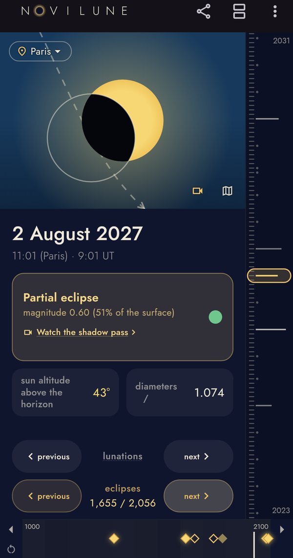
At every conjunction of the Sun and the Moon, the app draws the two discs at their closest in the sky of the place you entered — your own town, or a city on the other side of the world. It gives you the local time, the fraction of the Sun covered, the altitude of the star above the horizon.

The verdict is about what that place saw, not about what happened beneath its feet: an eclipse that ran its whole course with the Sun below the horizon does not count as yours. The app says so, and points you to the map and the animation, which show where it could be seen. In Paris, that sorting halves the count.

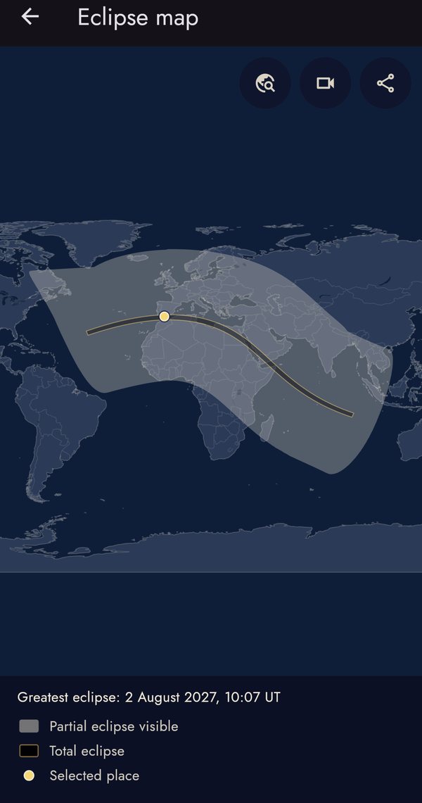
Most of the time the answer is “nothing”: the two discs miss each other by several diameters. That is precisely what makes the other times interesting. When there is an eclipse, a world map shows where the central path runs and how far the partial zone extends — and where you stand in relation to it.

The next three

An Iberian trilogy, then nothing as favourable for a long time

South-western Europe is going through an unusual sequence. The eclipse of 2 August 2027 is the longest total eclipse observable from land before 2114.

DateType and pathDuration
2027-02-06 Annular — Chile, Argentina, Uruguay, southern Brazil, then the Atlantic and West Africa 7 min 51 s
2027-08-02 Total — southern Spain, Morocco, Algeria, Tunisia, Libya, Egypt. Partial across the whole of mainland France 6 min 23 s
2028-01-26 Annular — Ecuador, Peru, Brazil, French Guiana, then Portugal and half of Spain at sunset 10 min 27 s
Method

This is not an artist's impression

The positions come from the Jet Propulsion Laboratory's DE441 planetary ephemeris, the same one used for nautical almanacs and eclipse canons. They are pre-computed by a generator independent of the app, stored as true equatorial vectors of date in the form of Chebyshev coefficients, then split century by century. At display time the app does only one thing: bring those positions down to your location — parallax, altitude, refraction.

That division has a practical consequence: everything is on board. No network requests, no server, no account. The app works in a desert, at sea, or on a train with no signal, exactly as it does on the sofa.

The thing no other almanac shows

The uncertainty is drawn, not hidden

The Earth does not turn like a regular clock. The accumulated difference between ephemeris time and rotation time — what astronomers call ΔT — is measured for recent epochs, reconstructed from ancient observations for antiquity, and purely extrapolated for the future. One second of error in ΔT shifts the entire path of totality by fifteen arcseconds of longitude.

Novilune does not pretend to ignore it. The central path is drawn with its real margin, which widens as you move away from our own era. Below, the width of that margin across the five millennia the app covers.

−2000 −1000 0 +1000 +2000 +3000 YEAR MARGIN, IN DEGREES OF LONGITUDE ± 15.6° ± 2.6° at 1000 BC ± 0° — measured epoch ± 7.9°

Standard deviation of ΔT converted into longitude, after Espenak & Meeus,
Five Millennium Canon of Solar Eclipses (NASA/TP-2006-214141).

For the Assyrian eclipse of Bur-Sagale, in 763 BC, that margin is 2.2° — nearly two hundred kilometres of play in the position of the path. For the eclipse of Thales, in 585 BC, 1.9°. That is exactly what you need to know before concluding anything about a battle between Medes and Lydians.

New

The shadow, moving

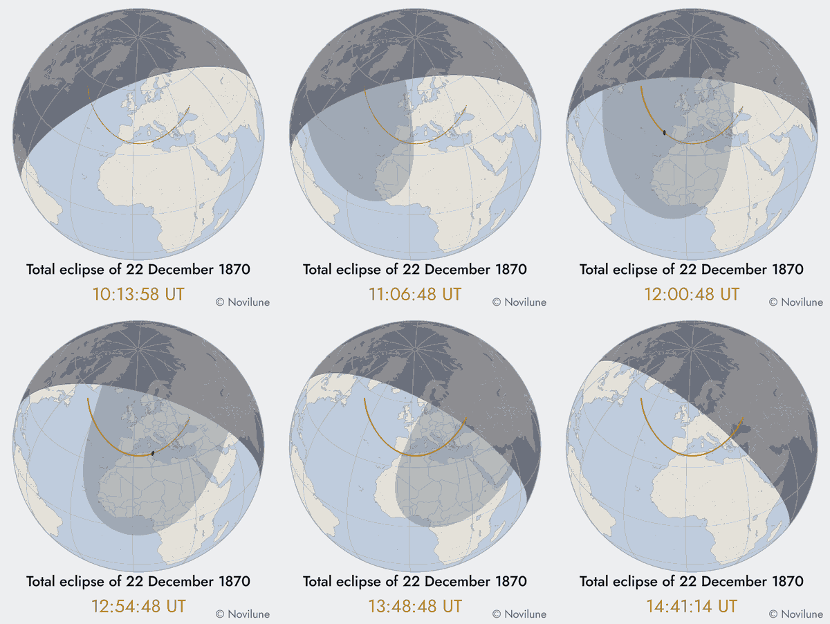
A map tells you where the shadow goes. It does not tell you how. Novilune now animates the Moon's shadow racing across the globe, frame by frame: you watch it reach the Earth, cross it from west to east at more than a thousand kilometres an hour, then leave by the far edge — and you understand at once why so few people ever see a totality.

Five settings, each shown with the length and weight of the film before it is made: globe or flat map, fixed camera or one that follows the shadow, speed, quality, colours. The film plays on a loop inside the app; sharing it as a GIF belongs to the complete version.

Animation computed by Novilune: the Moon's shadow crosses the Atlantic, Spain, Algeria and Sicily on 22 December 1870.
The eclipse of 22 December 1870, from the Atlantic to Sicily. The dark spot is the umbra, the grey area the penumbra, the golden line the central path.
Inside the app

Seven screens

On first launch, a five-step guided tour points at each part of the screen — the app opens already alive on a large city, rather than on a form.

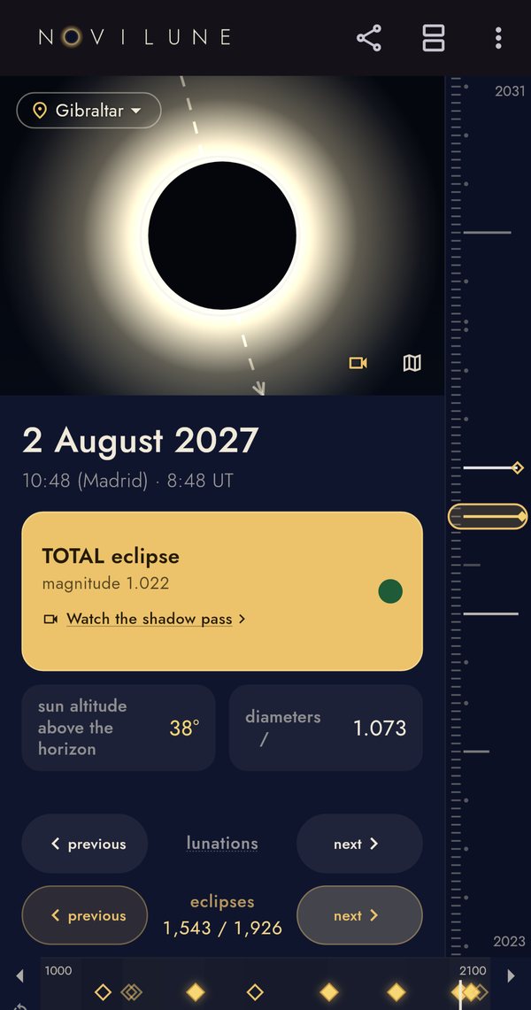
2 August 2027 seen from Gibraltar: the two discs at maximum
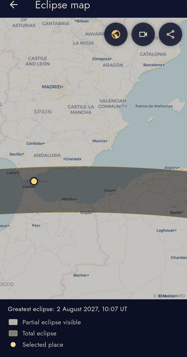
The map of 2 August 2027, zoomed on the Strait of Gibraltar
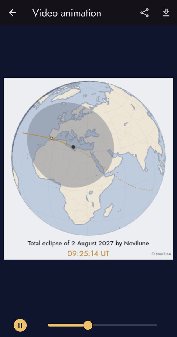
The animation of the shadow crossing the Earth
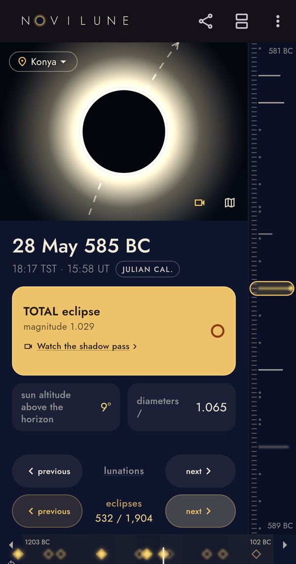
The eclipse of 28 May 585 BC: the battle of the Halys
The five-millennium timeline, from 2000 BC to AD 3000
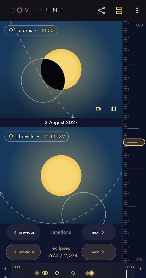
Two places compared side by side, each at its own local maximum
The whole-world map, which works with no network
Price

Two centuries free, and three differences

Free

From 1900 to 2100, for one place at a time. Every eclipse of our own era, with the maps, the animation and PNG export. That range was chosen because it is clean: no Julian calendar, no apparent solar time, no visible margin of uncertainty.

Complete — €4.99

A one-off purchase, no subscription. It opens the five millennia, from 2000 BC to AD 3000, the side-by-side comparison of two places, and sharing the animation as a GIF. Three differences, and not one more: everything else is identical in both versions.