Novilune — solar eclipses: history, astronomy, observing
Solar eclipse · Wednesday 26 January 2028 · Santa Cruz de Tenerife, Spain

Partial eclipse in Santa Cruz de Tenerife, 26 January 2028

The Moon will cover at most 79% of the solar disc (magnitude 0.866), at 16:49:58 (local time in the Canary Islands). The Sun will then stand 20° above the horizon, towards the south-west. There is no totality here.

The path near you
Santa Cruz de Tenerife lies outside the path of annularity. Its edge runs 185 km towards the north-north-west — that is where you have to stand to see the ring close.

eclipse path Novilune (map Natural Earth and GeoNames)

  • path of annularity
  • centre line
  • Santa Cruz de Tenerife
  • sees the ring
  • partial eclipse only
Santa Cruz de Tenerife lies outside the path of annularity. Its edge runs 185 km towards the north-north-west — that is where you have to stand to see the ring close.
The times, for Santa Cruz de Tenerife
PhaseLocal timeUTSun's altitudealt.
First contact — the Moon touches the Sun15:19:0815:19:0834°
Maximum16:49:5816:49:5820°
Last contact — the Moon leaves the Sun18:07:5918:07:59
What you will see
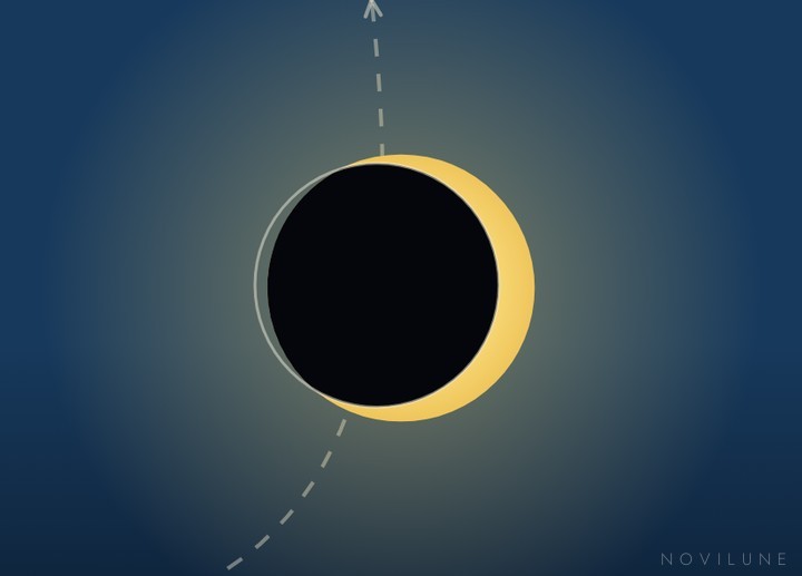
Maximum as seen from Santa Cruz de Tenerife, drawn by Novilune.

For about two hours the Moon eats into the solar disc and then releases it. To the naked eye the drop in light is hardly noticeable until three quarters of the Sun are covered; here, at maximum, 79% of the disc will be hidden. The drop in light will be noticeable to anyone paying attention, no more than that.

To see totality you must be inside the path of totality — the eclipse map and the list of cities on the eclipse page show where it runs.

In Santa Cruz de Tenerife, on 26 January 2028, there is no moment at which the Sun can be looked at without protection: eclipse glasses (ISO 12312-2) or projection onto a sheet of paper, from first to last contact.

How to look without burning your eyes →

The eclipse worldwide
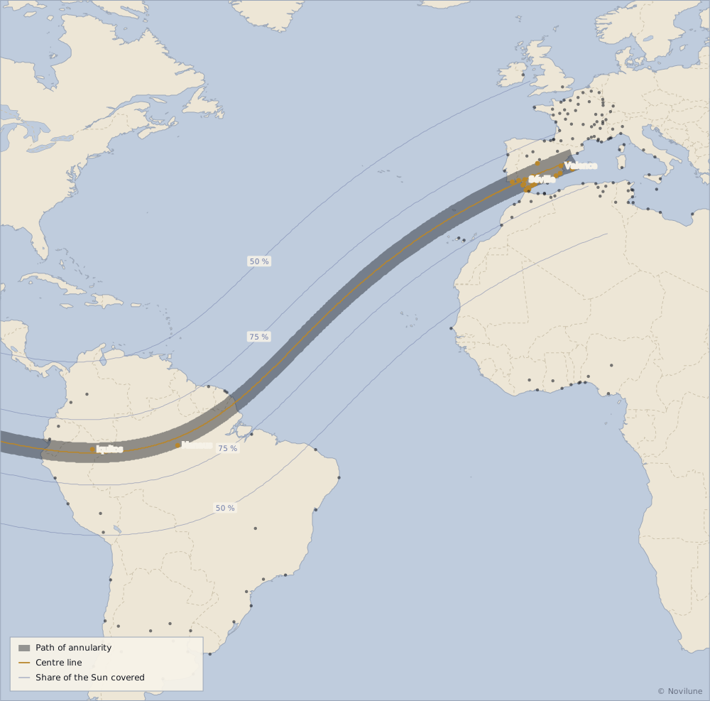
Where the eclipse passes. The golden dots mark the towns that see the central phase, the dark ones those where the Sun is only partly hidden. Map computed by Novilune.
Where these figures come from

Times and geometry computed by Novilune for the point 28.4672° N, 16.2508° W (altitude 37 m), from the Jet Propulsion Laboratory's DE441 ephemeris, with ΔT = 69.3 s. The uncertainty on ΔT (± 6 s) shifts all the times together by a few seconds at most; atmospheric refraction is not applied (it does not change the contact times appreciably at this altitude of the Sun).

Times are given in local time in the Canary Islands (UT +00:00).

In the app

Novilune draws this eclipse as it will be seen from Santa Cruz de Tenerife — the two discs at maximum, the Moon's path, the map of the path of totality — and does the same for every new moon from 2000 BC to AD 3000, for any place on Earth, offline.

View on Google Play Android · free from 1900 to 2100

All cities, the map and the path of totality →

Also computed for this eclipse